 vesseltracker.com
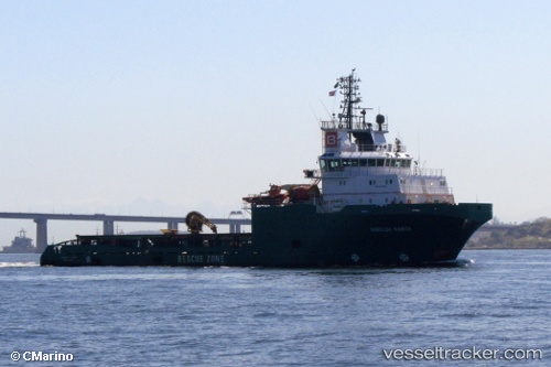
Vessel Haroldo Ramos IMO: 9270244, MMSI: 710053000 Offshore Tug Supply Ship
UTC, -23.79333, -41.31500, course: -1, speed: 7
UTC, -23.42667, -41.11167, course: -1, speed: 8
2026-02-27 11:52:15 UTC, -23.20167, -40.90167, course: -1, speed: 9
Live AIS position:
UTC. 43 nm SW of Fluminense FPSO),
updated 2026-02-27 11:52:15 UTC.
Find the position of the vessel Haroldo Ramos on the map. The latter are known coordinates and path.
marine traffic ship tracker show on live map
The current position of vessel Haroldo Ramos is -23.20167 lat / -40.90167 lng. Updated: 2026-02-27 11:52:15 UTCDetails:
Last coordinates of the vessel:
UTC, -23.99000, -41.48667, course: -1, speed: 8UTC, -23.79333, -41.31500, course: -1, speed: 7
UTC, -23.42667, -41.11167, course: -1, speed: 8
2026-02-27 11:52:15 UTC, -23.20167, -40.90167, course: -1, speed: 9