 vesseltracker.com
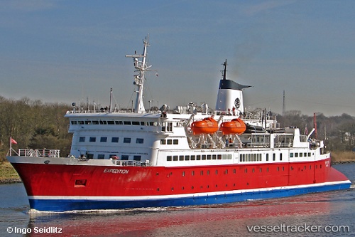
Vessel Expedition IMO: 7211074, MMSI: 636013956 Cruise Ship
UTC, 54.52219, 18.55746, course: 84, speed: 0
UTC, 54.52211, 18.55749, course: 84, speed: 0
2026-02-23 17:54:51 UTC, 54.52214, 18.55749, course: 84, speed: 0
Live AIS position:
UTC. Near Gdynia),
updated 2026-02-23 17:54:51 UTC.
Find the position of the vessel Expedition on the map. The latter are known coordinates and path.
marine traffic ship tracker show on live map
The current position of vessel Expedition is 54.52214 lat / 18.55749 lng. Updated: 2026-02-23 17:54:51 UTCCurrently sailing under the flag of Liberia
Expedition built in 1972 year
Deadweight:
965 tDetails:
Last coordinates of the vessel:
UTC, 54.52216, 18.55750, course: 84, speed: 0UTC, 54.52219, 18.55746, course: 84, speed: 0
UTC, 54.52211, 18.55749, course: 84, speed: 0
2026-02-23 17:54:51 UTC, 54.52214, 18.55749, course: 84, speed: 0