 vesseltracker.com
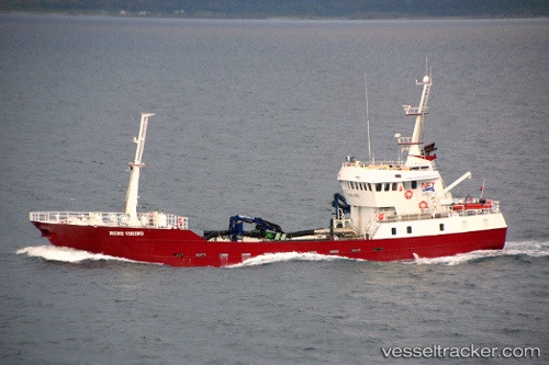
Vessel GRIP ANTARCTIC IMO: 9167954, MMSI: 725003741 Fish Carrier
UTC, -46.29167, -73.52167, course: -1, speed: 0
UTC, -46.29187, -73.52146, course: 275, speed: 0.1
2026-03-24 11:23:20 UTC, -46.29167, -73.52167, course: -1, speed: 0
Live Vessel GRIP ANTARCTIC Analytics (details, animations, etc.)
Live AIS position: UTC. 56 nm SW of Puerto Chacabuco), updated 2026-03-24 11:23:20 UTC.Find the position of the vessel GRIP ANTARCTIC on the map. The latter are known coordinates and path.
marine traffic ship tracker show on live map
The current position of vessel GRIP ANTARCTIC is -46.29167 lat / -73.52167 lng. Updated: 2026-03-24 11:23:20 UTCCurrently sailing under the flag of Chile
GRIP ANTARCTIC built in 1997 year
Deadweight:
1118 tDetails:
Last coordinates of the vessel:
UTC, -46.29167, -73.52167, course: -1, speed: 0UTC, -46.29167, -73.52167, course: -1, speed: 0
UTC, -46.29187, -73.52146, course: 275, speed: 0.1
2026-03-24 11:23:20 UTC, -46.29167, -73.52167, course: -1, speed: 0