 vesseltracker.com
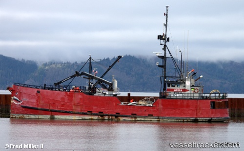
Vessel Rondys IMO: 7308255, MMSI: 366946980 Fishing Vessel
UTC, 54.13105, -165.81834, course: -1, speed: 0.1
UTC, 54.13126, -165.81819, course: -1, speed: 0
2026-03-24 15:49:53 UTC, 54.13119, -165.81787, course: -1, speed: 0.1
Live Vessel Rondys Analytics (details, animations, etc.)
Live AIS position: UTC. Near Akutan), updated 2026-03-24 15:49:53 UTC.Find the position of the vessel Rondys on the map. The latter are known coordinates and path.
marine traffic ship tracker show on live map
The current position of vessel Rondys is 54.13119 lat / -165.81787 lng. Updated: 2026-03-24 15:49:53 UTCDetails:
Last coordinates of the vessel:
UTC, 54.13130, -165.81792, course: -1, speed: 0.1UTC, 54.13105, -165.81834, course: -1, speed: 0.1
UTC, 54.13126, -165.81819, course: -1, speed: 0
2026-03-24 15:49:53 UTC, 54.13119, -165.81787, course: -1, speed: 0.1