 vesseltracker.com
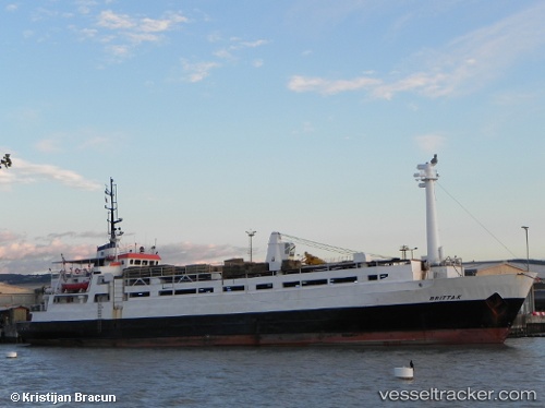
Vessel BRITTA K IMO: 7368815, MMSI: 620800074 Livestock Carrier
UTC, 27.55833, 34.00667, course: -1, speed: 11
UTC, 27.47415, 34.29003, course: -1, speed: 9.6
2026-03-24 11:36:57 UTC, 27.51478, 34.65325, course: -1, speed: 9.3
Live Vessel BRITTA K Analytics (details, animations, etc.)
Live AIS position: UTC. 29 nm SE of Sharm ash Shaykh), updated 2026-03-24 11:36:57 UTC.Find the position of the vessel BRITTA K on the map. The latter are known coordinates and path.
marine traffic ship tracker show on live map
The current position of vessel BRITTA K is 27.51478 lat / 34.65325 lng. Updated: 2026-03-24 11:36:57 UTCCurrently sailing under the flag of Comoros
Details:
Last coordinates of the vessel:
UTC, 27.79802, 33.75329, course: -1, speed: 9.9UTC, 27.55833, 34.00667, course: -1, speed: 11
UTC, 27.47415, 34.29003, course: -1, speed: 9.6
2026-03-24 11:36:57 UTC, 27.51478, 34.65325, course: -1, speed: 9.3