 vesseltracker.com
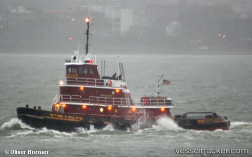
Vessel Marjorie B Mcalliste IMO: 7391020, MMSI: 367179990 Tug
UTC, 40.63911, -74.19185, course: 55, speed: 0
UTC, 40.64403, -74.16662, course: 305, speed: 6.3
2026-03-24 09:30:56 UTC, 40.62880, -74.20109, course: 15, speed: 0
Live Vessel Marjorie B Mcalliste Analytics (details, animations, etc.)
Live AIS position: UTC. Near Bayway), updated 2026-03-24 09:30:56 UTC.Find the position of the vessel Marjorie B Mcalliste on the map. The latter are known coordinates and path.
marine traffic ship tracker show on live map
The current position of vessel Marjorie B Mcalliste is 40.62880 lat / -74.20109 lng. Updated: 2026-03-24 09:30:56 UTCDetails:
Last coordinates of the vessel:
UTC, 40.63910, -74.19190, course: 55, speed: 0UTC, 40.63911, -74.19185, course: 55, speed: 0
UTC, 40.64403, -74.16662, course: 305, speed: 6.3
2026-03-24 09:30:56 UTC, 40.62880, -74.20109, course: 15, speed: 0