 vesseltracker.com
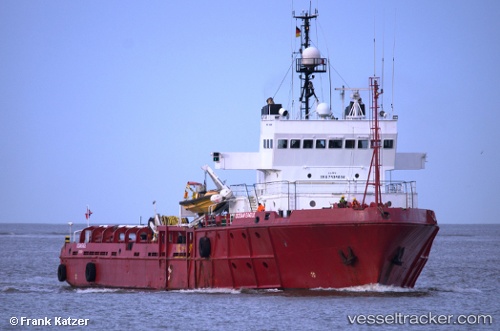
Vessel Sea Meadow 02 IMO: 7434690, MMSI: 353121000 Offshore Tug Supply Ship
UTC, 10.60134, -58.45925, course: 96, speed: 4.6
UTC, 10.58833, -58.34500, course: -1, speed: 4
2026-03-24 09:09:06 UTC, 10.60167, -58.44833, course: -1, speed: 3
Live Vessel Sea Meadow 02 Analytics (details, animations, etc.)
Live AIS position: UTC. 131 nm E of Charlotteville), updated 2026-03-24 09:09:06 UTC.Find the position of the vessel Sea Meadow 02 on the map. The latter are known coordinates and path.
marine traffic ship tracker show on live map
The current position of vessel Sea Meadow 02 is 10.60167 lat / -58.44833 lng. Updated: 2026-03-24 09:09:06 UTCDetails:
Last coordinates of the vessel:
UTC, 10.62500, -58.67667, course: -1, speed: 5UTC, 10.60134, -58.45925, course: 96, speed: 4.6
UTC, 10.58833, -58.34500, course: -1, speed: 4
2026-03-24 09:09:06 UTC, 10.60167, -58.44833, course: -1, speed: 3