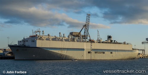
 SAPHIRA
Current Status
Where is the vessel?
SAPHIRA is currently in Near Port Sultan, based on AIS data received about 15h ago.
Latest AIS update:
Current position: 23.64435° N, 58.62385° E (Near Port Sultan)
Average speed (last 7 days): Loading…
Average speed (last 30 days): Loading…
Vessel profile: SAPHIRA is a Livestock Carrier with dimensions m x m.
This page combines live AIS, route history, probable destination signals, nearby traffic, and port activity for practical vessel monitoring.
The current position of vessel SAPHIRA is 23.64435 lat / 58.62385 lng. Updated: 2026-05-23 19:20:47 UTCNearest reference points:
- 58 nm S of JASK
- 23 nm NE of Qalhat
- 42 nm SE of Offshore Fujairah
Currently sailing under the flag of Antigua and Barbuda ![]()
Details:
Live Vessel SAPHIRA Analytics (details, animations, etc.)
Recent AIS points (UTC):
2026-05-23 15:56:15 UTC · 23.66156, 58.57476 · SOG 0 kn · COG 112°2026-05-23 17:19:51 UTC · 23.66170, 58.57482 · SOG 0 kn · COG 112°
2026-05-23 19:12:07 UTC · 23.65253, 58.59845 · SOG 8.8 kn · COG 108°
2026-05-23 19:20:47 UTC · 23.64435, 58.62385 · SOG 11 kn · COG 108°