 vesseltracker.com
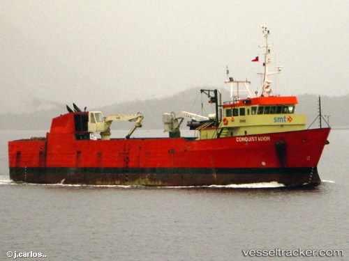
Vessel Conquistador IMO: 8019629, MMSI: 725001490 General Cargo Ship
UTC, -44.15346, -73.68375, course: -1, speed: 0.5
UTC, -44.11959, -73.65728, course: -1, speed: 0.1
2026-03-24 13:26:49 UTC, -44.15768, -73.73590, course: -1, speed: 5.9
Live Vessel Conquistador Analytics (details, animations, etc.)
Live AIS position: UTC. 17 nm S of Melinka), updated 2026-03-24 13:26:49 UTC.Find the position of the vessel Conquistador on the map. The latter are known coordinates and path.
marine traffic ship tracker show on live map
The current position of vessel Conquistador is -44.15768 lat / -73.73590 lng. Updated: 2026-03-24 13:26:49 UTCDetails:
Last coordinates of the vessel:
UTC, -44.15365, -73.68325, course: -1, speed: 0.1UTC, -44.15346, -73.68375, course: -1, speed: 0.5
UTC, -44.11959, -73.65728, course: -1, speed: 0.1
2026-03-24 13:26:49 UTC, -44.15768, -73.73590, course: -1, speed: 5.9