 vesseltracker.com
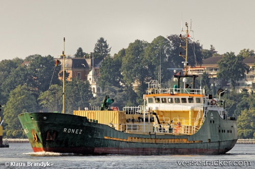
 Ronez
Ronez
Current Status
Where is the vessel?
Ronez is currently in Near MOERDIJK, based on AIS data received about 2h ago.
Latest AIS update:
Current position: 51.68822° N, 4.59878° E (Near MOERDIJK)
Average speed (last 7 days): Loading…
Average speed (last 30 days): Loading…
Vessel profile: Ronez is a Cement Carrier with dimensions 60m x 10m.
This page combines live AIS, route history, probable destination signals, nearby traffic, and port activity for practical vessel monitoring.
The current position of vessel Ronez is 51.68822 lat / 4.59878 lng. Updated: 2026-03-26 04:01:11 UTCNearest reference points:
- Near MOERDIJK
- Near STRIJENSAS
- Near Mookhoek
Currently sailing under the flag of United Kingdom ![]()
Ronez built in 1982 year
Deadweight:
1117 tDetails:
Live Vessel Ronez Analytics (details, animations, etc.)
Recent AIS points (UTC):
2026-03-25 21:37:13 UTC · 51.68821, 4.59880 · SOG 0 kn · COG 103°2026-03-25 23:43:12 UTC · 51.68820, 4.59876 · SOG 0 kn · COG 103°
2026-03-26 01:37:14 UTC · 51.68823, 4.59883 · SOG 0 kn · COG 103°
2026-03-26 04:01:11 UTC · 51.68822, 4.59878 · SOG 0 kn · COG 102°