 vesseltracker.com
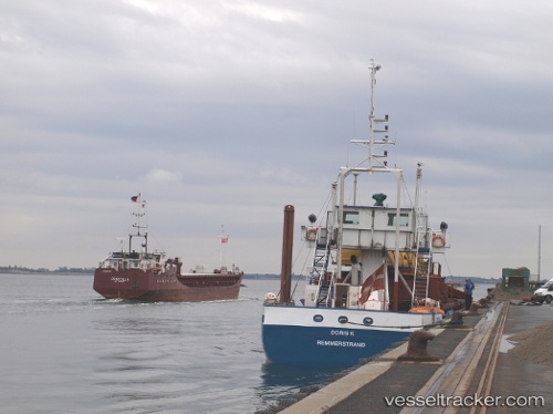
 Doris K
Current Status
Where is the vessel?
Doris K is currently in Near Copenhagen, based on AIS data received about 2h ago.
Latest AIS update:
Current position: 55.69101° N, 12.62555° E (Near Copenhagen)
Average speed (last 7 days): Loading…
Average speed (last 30 days): Loading…
Vessel profile: Doris K is a Hopper Dredger with dimensions 75m x 9m.
This page combines live AIS, route history, probable destination signals, nearby traffic, and port activity for practical vessel monitoring.
The current position of vessel Doris K is 55.69101 lat / 12.62555 lng. Updated: 2026-03-25 15:49:36 UTCNearest reference points:
- Near Skanör
- Near Rungsted
- Near Land Skrona
Currently sailing under the flag of Denmark ![]()
Doris K built in 1982 year
Deadweight:
1089 tDetails:
Live Vessel Doris K Analytics (details, animations, etc.)
Recent AIS points (UTC):
2026-03-25 09:26:18 UTC · 55.72689, 12.60362 · SOG 0.4 kn · COG 130°2026-03-25 11:43:15 UTC · 55.72592, 12.60329 · SOG 0 kn · COG 95°
2026-03-25 14:17:38 UTC · 55.72663, 12.65778 · SOG 9.9 kn · COG 110°
2026-03-25 15:49:36 UTC · 55.69101, 12.62555 · SOG 0 kn · COG 107°