 vesseltracker.com
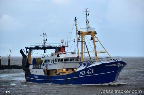
Vessel Annegina IMO: 8205852, MMSI: 235005770 Fishing Vessel
UTC, 52.45802, 4.58468, course: 118, speed: 0
UTC, 52.45800, 4.58471, course: 117, speed: 0
2026-02-15 16:37:42 UTC, 52.45800, 4.58470, course: 118, speed: 0
Live AIS position:
UTC. Near Ijmuiden),
updated 2026-02-15 16:37:42 UTC.
Find the position of the vessel Annegina on the map. The latter are known coordinates and path.
marine traffic ship tracker show on live map
The current position of vessel Annegina is 52.45800 lat / 4.58470 lng. Updated: 2026-02-15 16:37:42 UTCCurrently sailing under the flag of United Kingdom
Annegina built in 1984 year
Details:
Last coordinates of the vessel:
UTC, 52.45800, 4.58469, course: 117, speed: 0UTC, 52.45802, 4.58468, course: 118, speed: 0
UTC, 52.45800, 4.58471, course: 117, speed: 0
2026-02-15 16:37:42 UTC, 52.45800, 4.58470, course: 118, speed: 0