 vesseltracker.com
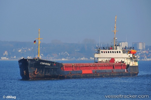
Vessel Staropolye IMO: 8230522, MMSI: 273314900 General Cargo Ship
UTC, 46.33931, 47.69137, course: 22, speed: 13.5
UTC, 46.33931, 47.69137, course: 22, speed: 13.5
2026-02-25 22:38:52 UTC, 46.33931, 47.69137, course: 22, speed: 13.5
Live AIS position:
UTC. 11 nm NW of Krasnyye Barrikady),
updated 2026-02-25 22:38:52 UTC.
Find the position of the vessel Staropolye on the map. The latter are known coordinates and path.
marine traffic ship tracker show on live map
The current position of vessel Staropolye is 46.33931 lat / 47.69137 lng. Updated: 2026-02-25 22:38:52 UTCDetails:
Last coordinates of the vessel:
UTC, 46.33941, 47.69344, course: 22, speed: 8.3UTC, 46.33931, 47.69137, course: 22, speed: 13.5
UTC, 46.33931, 47.69137, course: 22, speed: 13.5
2026-02-25 22:38:52 UTC, 46.33931, 47.69137, course: 22, speed: 13.5