 vesseltracker.com
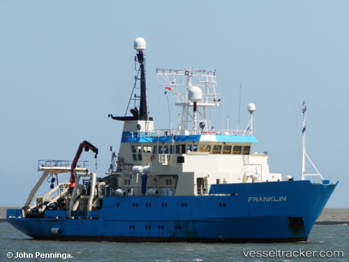
Vessel NORTHERN FRANKLIN IMO: 8301797, MMSI: 219028268 Research Vessel
UTC, 56.15095, 10.21668, course: 252, speed: 0
UTC, 56.15100, 10.21667, course: 252, speed: 0
2026-03-24 20:09:07 UTC, 56.15100, 10.21664, course: -1, speed: 0
Live Vessel NORTHERN FRANKLIN Analytics (details, animations, etc.)
Live AIS position: UTC. Near Aarhus), updated 2026-03-24 20:09:07 UTC.Find the position of the vessel NORTHERN FRANKLIN on the map. The latter are known coordinates and path.
marine traffic ship tracker show on live map
The current position of vessel NORTHERN FRANKLIN is 56.15100 lat / 10.21664 lng. Updated: 2026-03-24 20:09:07 UTCCurrently sailing under the flag of Denmark (DIS)
NORTHERN FRANKLIN built in 1985 year
Deadweight:
1218 tDetails:
Last coordinates of the vessel:
UTC, 56.15099, 10.21663, course: 252, speed: 0UTC, 56.15095, 10.21668, course: 252, speed: 0
UTC, 56.15100, 10.21667, course: 252, speed: 0
2026-03-24 20:09:07 UTC, 56.15100, 10.21664, course: -1, speed: 0