 vesseltracker.com
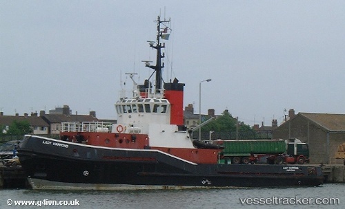
Vessel Lady Hammond IMO: 8317643, MMSI: 470909000 Offshore Tug Supply Ship
UTC, 24.69500, 53.66500, course: -1, speed: 0
UTC, 24.83667, 53.66333, course: -1, speed: 3
2026-03-24 11:44:43 UTC, 24.84378, 53.66215, course: 205, speed: 0
Live Vessel Lady Hammond Analytics (details, animations, etc.)
Live AIS position: UTC. 25 nm N of Mubarraz Island), updated 2026-03-24 11:44:43 UTC.Find the position of the vessel Lady Hammond on the map. The latter are known coordinates and path.
marine traffic ship tracker show on live map
The current position of vessel Lady Hammond is 24.84378 lat / 53.66215 lng. Updated: 2026-03-24 11:44:43 UTCCurrently sailing under the flag of UAE
Details:
Last coordinates of the vessel:
UTC, 24.69500, 53.65833, course: -1, speed: 1UTC, 24.69500, 53.66500, course: -1, speed: 0
UTC, 24.83667, 53.66333, course: -1, speed: 3
2026-03-24 11:44:43 UTC, 24.84378, 53.66215, course: 205, speed: 0