 vesseltracker.com
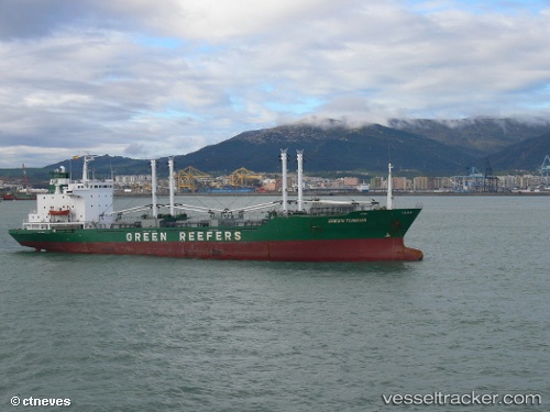
Green Tundra
Current StatusWhere is the vessel?
Green Tundra is currently in 112 nm NE of Okha, based on AIS data received about 2h ago.
Latest AIS update:
Current position: 54.62500° N, 145.69501° E (112 nm NE of Okha)
Average speed (last 7 days): Loading…
Average speed (last 30 days): Loading…
Vessel profile: Green Tundra is a Refrigerated Cargo Ship with dimensions 18m x 114m.
This page combines live AIS, route history, probable destination signals, nearby traffic, and port activity for practical vessel monitoring.
The current position of vessel Green Tundra is 54.62500 lat / 145.69501 lng. Updated: 2026-03-25 18:10:48 UTCNearest reference points:
- 38 nm E of Widuchowa
- 37 nm E of Widuchowa
- 46 nm SE of Widuchowa
Details:
Live Vessel Green Tundra Analytics (details, animations, etc.)
Recent AIS points (UTC):
2026-03-25 12:03:26 UTC · 52.87426, 146.28529 · SOG 17.6 kn · COG 349°2026-03-25 14:19:36 UTC · 53.52207, 146.06143 · SOG 17.4 kn · COG 347°
2026-03-25 15:34:54 UTC · 53.88167, 145.93500 · SOG 17 kn · COG -1°
2026-03-25 18:10:48 UTC · 54.62500, 145.69501 · SOG 17 kn · COG -1°