 vesseltracker.com
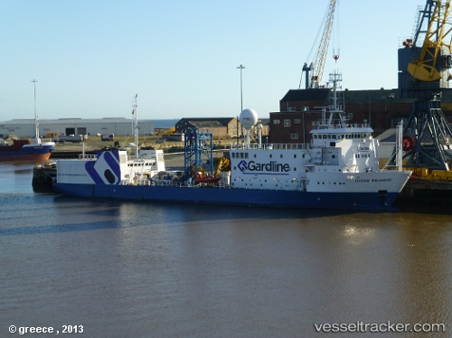
 OCEAN RELIANCE
Current Status
Where is the vessel?
OCEAN RELIANCE is currently in Near Hull, based on AIS data received about 1h ago.
Latest AIS update:
Current position: 53.73403° N, 0.35108° W (Near Hull)
Average speed (last 7 days): Loading…
Average speed (last 30 days): Loading…
Vessel profile: OCEAN RELIANCE is a Research/Survey Vessel with dimensions m x m.
This page combines live AIS, route history, probable destination signals, nearby traffic, and port activity for practical vessel monitoring.
The current position of vessel OCEAN RELIANCE is 53.73403 lat / -0.35108 lng. Updated: 2026-03-25 21:24:36 UTCNearest reference points:
- Near Hull
- Near Hessle/Hull
- Near Immingham
Currently sailing under the flag of Bahamas ![]()
Details:
Live Vessel OCEAN RELIANCE Analytics (details, animations, etc.)
Recent AIS points (UTC):
2026-03-25 16:09:35 UTC · 53.73400, -0.35108 · SOG 0 kn · COG 61°2026-03-25 17:56:42 UTC · 53.73399, -0.35107 · SOG 0 kn · COG 61°
2026-03-25 20:13:57 UTC · 53.73402, -0.35106 · SOG 0 kn · COG 62°
2026-03-25 21:24:36 UTC · 53.73403, -0.35108 · SOG 0 kn · COG 61°