 vesseltracker.com
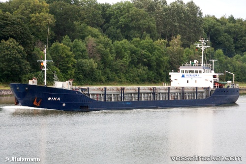
Vessel Nina IMO: 8618035, MMSI: 230681000 General Cargo Ship
Live Vessel Nina Analytics (details, animations, etc.)
Live AIS position: UTC. Near Nyslott (Savonlinna)), updated 2026-02-12 18:44:03 UTC.Find the position of the vessel Nina on the map. The latter are known coordinates and path.
marine traffic ship tracker show on live map
The current position of vessel Nina is 61.84333 lat / 28.94333 lng. Updated: 2026-02-12 18:44:03 UTCCurrently sailing under the flag of Finland
Nina built in 1987 year
Deadweight:
2723 tDetails:
Last coordinates of the vessel:
2026-02-12 18:44:03 UTC, 61.84333, 28.94333, course: -1, speed: 0