 vesseltracker.com
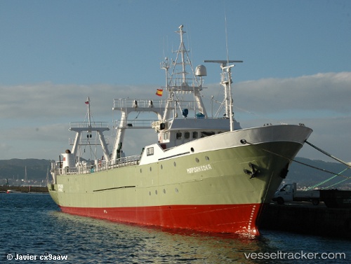
Vessel Tatekulu Andimba IMO: 8701179, MMSI: 659470000 Fishing Vessel
UTC, -26.09815, 14.29864, course: 175, speed: 9.9
UTC, -26.45914, 14.31974, course: 175, speed: 8.9
2026-03-24 15:37:48 UTC, -26.82699, 14.34811, course: 175, speed: 10.7
Live Vessel Tatekulu Andimba Analytics (details, animations, etc.)
Live AIS position: UTC. 45 nm W of Luderitz Bay), updated 2026-03-24 15:37:48 UTC.Find the position of the vessel Tatekulu Andimba on the map. The latter are known coordinates and path.
marine traffic ship tracker show on live map
The current position of vessel Tatekulu Andimba is -26.82699 lat / 14.34811 lng. Updated: 2026-03-24 15:37:48 UTCDetails:
Last coordinates of the vessel:
UTC, -25.80815, 14.27828, course: 176, speed: 9.8UTC, -26.09815, 14.29864, course: 175, speed: 9.9
UTC, -26.45914, 14.31974, course: 175, speed: 8.9
2026-03-24 15:37:48 UTC, -26.82699, 14.34811, course: 175, speed: 10.7