 vesseltracker.com
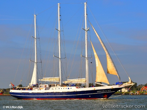
Vessel Eendracht IMO: 8814275, MMSI: 244543000 Training Ship
UTC, 9.55494, -79.66420, course: 7, speed: 0.1
UTC, 9.55544, -79.66461, course: 53, speed: 0
2026-02-14 14:09:30 UTC, 9.55566, -79.66474, course: 84, speed: 0
Live AIS position:
UTC. Near Portobelo),
updated 2026-02-14 14:09:30 UTC.
Find the position of the vessel Eendracht on the map. The latter are known coordinates and path.
marine traffic ship tracker show on live map
The current position of vessel Eendracht is 9.55566 lat / -79.66474 lng. Updated: 2026-02-14 14:09:30 UTCCurrently sailing under the flag of Netherlands
Eendracht built in 1989 year
Deadweight:
60 tDetails:
Last coordinates of the vessel:
UTC, 9.55500, -79.66333, course: -1, speed: 0UTC, 9.55494, -79.66420, course: 7, speed: 0.1
UTC, 9.55544, -79.66461, course: 53, speed: 0
2026-02-14 14:09:30 UTC, 9.55566, -79.66474, course: 84, speed: 0