 vesseltracker.com
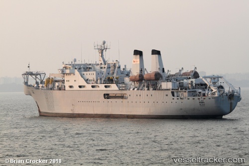
Vessel Niwa IMO: 8819029, MMSI: 470773000 Cable Layer
UTC, 28.35244, 33.20256, course: 321, speed: 0
UTC, 28.35243, 33.20253, course: -1, speed: 0.2
2026-03-12 19:23:54 UTC, 28.35237, 33.20254, course: 298, speed: 0.1
Live Vessel Niwa Analytics (details, animations, etc.)
Live AIS position: UTC. Near Ras Gharib), updated 2026-03-12 19:23:54 UTC.Find the position of the vessel Niwa on the map. The latter are known coordinates and path.
marine traffic ship tracker show on live map
The current position of vessel Niwa is 28.35237 lat / 33.20254 lng. Updated: 2026-03-12 19:23:54 UTCCurrently sailing under the flag of UAE
Niwa built in 1991 year
Deadweight:
7900 tDetails:
Last coordinates of the vessel:
UTC, 28.35242, 33.20262, course: 322, speed: 0.1UTC, 28.35244, 33.20256, course: 321, speed: 0
UTC, 28.35243, 33.20253, course: -1, speed: 0.2
2026-03-12 19:23:54 UTC, 28.35237, 33.20254, course: 298, speed: 0.1