 vesseltracker.com
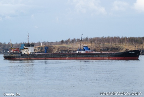
Vessel Omskiy 117 IMO: 8874421, MMSI: 620133000 General Cargo Ship
UTC, 45.66839, 36.79295, course: -1, speed: 8.1
UTC, 45.66839, 36.79295, course: -1, speed: 8.1
2026-03-22 10:00:28 UTC, 45.66839, 36.79295, course: -1, speed: 8.1
Live Vessel Omskiy 117 Analytics (details, animations, etc.)
Live AIS position: UTC. 15 nm N of Kavkaz), updated 2026-03-22 10:00:28 UTC.Find the position of the vessel Omskiy 117 on the map. The latter are known coordinates and path.
marine traffic ship tracker show on live map
The current position of vessel Omskiy 117 is 45.66839 lat / 36.79295 lng. Updated: 2026-03-22 10:00:28 UTCCurrently sailing under the flag of Comoros
Omskiy 117 built in 1983 year
Deadweight:
3197 tDetails:
Last coordinates of the vessel:
UTC, 45.82569, 36.87914, course: -1, speed: 7.9UTC, 45.66839, 36.79295, course: -1, speed: 8.1
UTC, 45.66839, 36.79295, course: -1, speed: 8.1
2026-03-22 10:00:28 UTC, 45.66839, 36.79295, course: -1, speed: 8.1