 vesseltracker.com
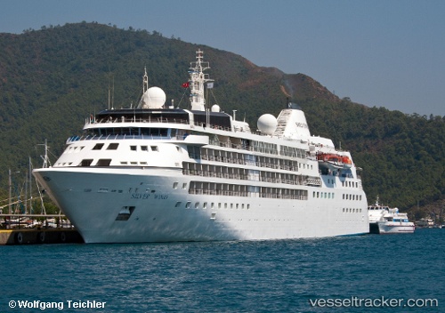
Silver Wind
Current StatusLive Vessel Silver Wind Analytics (details, animations, etc.)
Where is the vessel?
Silver Wind is currently in 131 nm N of Grytviken, based on AIS data received about 1h ago.
Latest AIS update:
Current position: 52.08306° S, 36.39730° W (131 nm N of Grytviken)
Vessel profile: Silver Wind is a Cruise Ship with dimensions 156m x 21m.
This page combines live AIS, route history, probable destination signals, nearby traffic, and port activity for practical vessel monitoring.
The current position of vessel Silver Wind is -52.08306 lat / -36.39730 lng. Updated: 2026-03-25 06:12:00 UTCNearest reference points:
- 15 nm SE of Grytviken
Currently sailing under the flag of Bahamas
Silver Wind built in 1995 year
Deadweight:
1790 tDetails:
Recent AIS points (UTC):
2026-03-25 00:11:40 UTC · -53.50232, -36.38061 · SOG 10.5 kn · COG 1°2026-03-25 01:35:18 UTC · -53.22539, -36.38137 · SOG 15.3 kn · COG 3°
2026-03-25 03:49:49 UTC · -52.66311, -36.39752 · SOG 15 kn · COG 1°
2026-03-25 06:12:00 UTC · -52.08306, -36.39730 · SOG 15.2 kn · COG 352°