 vesseltracker.com
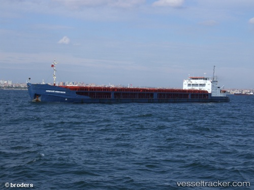
Rostov na donu
Current StatusWhere is the vessel?
Rostov na donu is currently in 11 nm NW of Kefken, based on AIS data received about 5h ago.
Latest AIS update:
Current position: 41.31353° N, 30.06517° E (11 nm NW of Kefken)
Average speed (last 7 days): Loading…
Average speed (last 30 days): Loading…
Vessel profile: Rostov na donu is a General Cargo Ship with dimensions 17m x 139m.
This page combines live AIS, route history, probable destination signals, nearby traffic, and port activity for practical vessel monitoring.
The current position of vessel Rostov na donu is 41.31353 lat / 30.06517 lng. Updated: 2026-03-25 03:53:41 UTCNearest reference points:
- Near Derince
- Near AUTOPORT
- Near KORFEZ
Details:
Live Vessel Rostov na donu Analytics (details, animations, etc.)
Recent AIS points (UTC):
2026-03-24 23:28:21 UTC · 41.25280, 29.22686 · SOG 8.6 kn · COG 69°2026-03-25 01:22:31 UTC · 41.28777, 29.59320 · SOG 8.5 kn · COG 82°
2026-03-25 03:53:41 UTC · 41.31353, 30.06517 · SOG 8.2 kn · COG 91°
2026-03-25 03:53:41 UTC · 41.31353, 30.06517 · SOG 8.2 kn · COG 91°