 vesseltracker.com
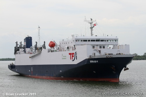
Vessel Mv.serasi 5 IMO: 9039573, MMSI: 525015778 Vehicles Carrier
UTC, 2.56500, 100.88833, course: -1, speed: 12
UTC, 2.47833, 101.18667, course: -1, speed: 12
2026-02-21 17:46:24 UTC, 2.24948, 101.50115, course: -1, speed: 11.2
Live AIS position:
UTC. 24 nm SW of PORT DICKSON),
updated 2026-02-21 17:46:24 UTC.
Find the position of the vessel Mv.serasi 5 on the map. The latter are known coordinates and path.
marine traffic ship tracker show on live map
The current position of vessel Mv.serasi 5 is 2.24948 lat / 101.50115 lng. Updated: 2026-02-21 17:46:24 UTCCurrently sailing under the flag of Indonesia
Details:
Last coordinates of the vessel:
UTC, 2.75109, 100.57539, course: -1, speed: 12.5UTC, 2.56500, 100.88833, course: -1, speed: 12
UTC, 2.47833, 101.18667, course: -1, speed: 12
2026-02-21 17:46:24 UTC, 2.24948, 101.50115, course: -1, speed: 11.2