 vesseltracker.com
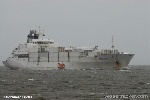
Vessel Dole Africa IMO: 9046538, MMSI: 311294000 Refrigerated Cargo Ship
UTC, 51.26150, 4.36428, course: 271, speed: 0.1
UTC, 51.26150, 4.36433, course: 272, speed: 0
2026-02-25 12:02:06 UTC, 51.26152, 4.36423, course: 271, speed: 0.1
Live AIS position:
UTC. Near Pijp Tabak),
updated 2026-02-25 12:02:06 UTC.
Find the position of the vessel Dole Africa on the map. The latter are known coordinates and path.
marine traffic ship tracker show on live map
The current position of vessel Dole Africa is 51.26152 lat / 4.36423 lng. Updated: 2026-02-25 12:02:06 UTCCurrently sailing under the flag of Bahamas
Dole Africa built in 1994 year
Deadweight:
10282 tDetails:
Last coordinates of the vessel:
UTC, 51.26155, 4.36426, course: 272, speed: 0.1UTC, 51.26150, 4.36428, course: 271, speed: 0.1
UTC, 51.26150, 4.36433, course: 272, speed: 0
2026-02-25 12:02:06 UTC, 51.26152, 4.36423, course: 271, speed: 0.1