 vesseltracker.com
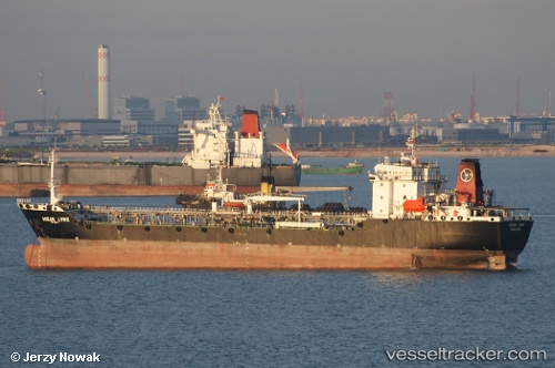
Vessel LYNX SATU IMO: 9075395, MMSI: 533150045 Oil Products Tanker
UTC, 16.10183, 96.27719, course: 26, speed: 0
UTC, 16.10167, 96.27833, course: -1, speed: 0
2026-03-24 20:18:28 UTC, 16.10515, 96.27951, course: 217, speed: 0.1
Live Vessel LYNX SATU Analytics (details, animations, etc.)
Live AIS position: UTC. 33 nm S of Thilawa), updated 2026-03-24 20:18:28 UTC.Find the position of the vessel LYNX SATU on the map. The latter are known coordinates and path.
marine traffic ship tracker show on live map
The current position of vessel LYNX SATU is 16.10515 lat / 96.27951 lng. Updated: 2026-03-24 20:18:28 UTCCurrently sailing under the flag of Malaysia
Details:
Last coordinates of the vessel:
UTC, 16.10217, 96.27702, course: 34, speed: 0.2UTC, 16.10183, 96.27719, course: 26, speed: 0
UTC, 16.10167, 96.27833, course: -1, speed: 0
2026-03-24 20:18:28 UTC, 16.10515, 96.27951, course: 217, speed: 0.1