.
vessel JAMILA IMO: 9083275, Bulk Carrier vesseltracker.com
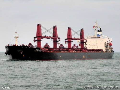
Vessel JAMILA IMO: 9083275, MMSI: 620981000 Bulk Carrier

callsign: D6A2989
size: 32x188

Live AIS position: UTC. Near Rufisque), updated 2023-09-13 11:04:06 UTC.

Find the position of the vessel JAMILA on the map. The latter are known coordinates and path.

marine traffic ship tracker show on live map

The current position of vessel JAMILA is 14.66029 lat / -17.31989 lng. Updated: 2023-09-13 11:04:06 UTC

Currently sailing under the flag of Comoros

JAMILA built in 1995 year

Deadweight:
46601 t

Details:


Last coordinates of the vessel:
2023-09-13 11:04:06 UTC, 14.66029, -17.31989, course: -1, speed: 0.1

Track of the vessel in the last 28 days


Most frequent ports a vessels calls at JAMILA (620981000):

Sambu, traffic: 8
Singapore, traffic: 4
Apapa, traffic: 4
Dagu Bar, traffic: 4
Dakar, traffic: 4
Lagos, traffic: 3
Taku Bar, traffic: 3
Tema, traffic: 3
Ta-Ku, traffic: 2
Dagu, traffic: 2
Strait Of Gibraltar, traffic: 1
Algiers, traffic: 1
Jebel Ali, traffic: 1

Link to the map:


Find another ship

JAMILA (620981000) last ports (portcalls and passsages)

Apapa | 2023-09-02 20:00:18
Lagos | 2023-09-02 16:15:33
Apapa | 2023-08-29 19:03:43
Lagos | 2023-08-29 15:47:11
Apapa | 2023-08-25 18:56:25
Lagos | 2023-08-25 15:01:40
Apapa | 2023-08-21 18:21:14
Dakar | 2023-08-08 14:05:49
Dakar | 2023-08-04 13:28:08
Dakar | 2023-07-31 12:44:59
Dakar | 2023-07-27 12:35:36
Tema | 2023-07-04 21:09:18
Tema | 2023-06-30 20:19:49
Tema | 2023-06-26 19:45:43
Strait Of Gibraltar | 2023-06-15 15:40:05
Algiers | 2023-06-13 19:38:05
Sambu | 2022-05-15 16:21:56
Jebel Ali | 2022-03-22 00:25:20
Ta-Ku | 2022-02-10 09:42:11
Dagu Bar | 2022-02-10 06:09:20
Taku Bar | 2022-02-09 12:22:59
Sambu | 2022-01-13 21:30:17
Singapore | 2022-01-13 20:45:38
Singapore | 2022-01-13 20:40:38
Sambu | 2022-01-13 20:35:19
Taku Bar | 2021-09-30 16:12:42