.
vessel Uk197 Noorderlicht IMO: 9085170, Fishing Vessel
vesseltracker.com
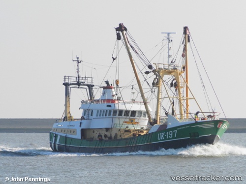
Vessel Uk197 Noorderlicht IMO: 9085170, MMSI: 246204000 Fishing Vessel

callsign: PGHQ
size: 41x8

Live AIS position: UTC. Near Ijmuiden), updated 2023-02-28 03:55:20 UTC.

Find the position of the vessel Uk197 Noorderlicht on the map. The latter are known coordinates and path.

marine traffic ship tracker show on live map

The current position of vessel Uk197 Noorderlicht is 52.46063 lat / 4.58060 lng. Updated: 2023-02-28 03:55:20 UTC

Currently sailing under the flag of Netherlands

Uk197 Noorderlicht built in 1993 year

Details:


Last coordinates of the vessel:
2023-02-28 03:55:20 UTC, 52.46063, 4.58060, course: 272.9, speed: 0

Track of the vessel in the last 28 days


Most frequent ports a vessels calls at Uk197 Noorderlicht (246204000):

Ijmuiden, traffic: 16

Link to the map:


Find another ship

Uk197_Noorderlicht (246204000) last ports (portcalls and passsages)

Ijmuiden | 2023-02-28 11:35:16
Ijmuiden | 2023-02-24 11:32:42
Ijmuiden | 2022-07-08 10:52:38
Ijmuiden | 2022-07-01 04:02:04
Ijmuiden | 2022-06-24 13:03:40
Ijmuiden | 2022-06-17 04:34:22
Ijmuiden | 2022-06-11 04:27:08
Ijmuiden | 2022-06-07 01:33:45
Ijmuiden | 2022-06-03 01:28:44
Ijmuiden | 2022-05-29 13:53:14
Ijmuiden | 2022-05-25 13:48:39
Ijmuiden | 2022-05-21 13:29:35
Ijmuiden | 2022-05-17 10:59:08
Ijmuiden | 2022-05-13 08:09:32
Ijmuiden | 2022-05-06 07:24:58
Ijmuiden | 2022-02-05 00:00:07