 vesseltracker.com
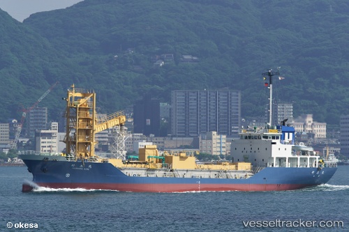
Vessel Takehara Maru IMO: 9088160, MMSI: 431400325 Limestone Carrier
UTC, 33.79817, 131.15163, course: -1, speed: 14.1
UTC, 33.80772, 131.07208, course: 89, speed: 0.3
2026-03-25 04:14:09 UTC, 33.80667, 131.07167, course: -1, speed: 0
Live Vessel Takehara Maru Analytics (details, animations, etc.)
Live AIS position: UTC. Near KANDA), updated 2026-03-25 04:14:09 UTC.Find the position of the vessel Takehara Maru on the map. The latter are known coordinates and path.
marine traffic ship tracker show on live map
The current position of vessel Takehara Maru is 33.80667 lat / 131.07167 lng. Updated: 2026-03-25 04:14:09 UTCDetails:
Last coordinates of the vessel:
UTC, 33.77500, 131.52333, course: -1, speed: 14UTC, 33.79817, 131.15163, course: -1, speed: 14.1
UTC, 33.80772, 131.07208, course: 89, speed: 0.3
2026-03-25 04:14:09 UTC, 33.80667, 131.07167, course: -1, speed: 0