 vesseltracker.com
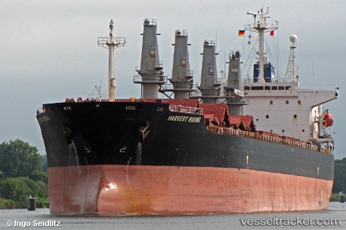
Vessel FU HAI IMO: 9119995, MMSI: 354863000 Bulk Carrier
UTC, 2.76818, 101.31915, course: 159, speed: 0.1
UTC, 2.76817, 101.32110, course: 214, speed: 0
2026-02-25 07:23:25 UTC, 2.76821, 101.32123, course: 218, speed: 0
Live AIS position:
UTC. Near Pulau Indah),
updated 2026-02-25 07:23:25 UTC.
Find the position of the vessel FU HAI on the map. The latter are known coordinates and path.
marine traffic ship tracker show on live map
The current position of vessel FU HAI is 2.76821 lat / 101.32123 lng. Updated: 2026-02-25 07:23:25 UTCCurrently sailing under the flag of Panama
FU HAI built in 1996 year
Deadweight:
46678 tDetails:
Last coordinates of the vessel:
UTC, 2.76695, 101.31819, course: 98, speed: 0UTC, 2.76818, 101.31915, course: 159, speed: 0.1
UTC, 2.76817, 101.32110, course: 214, speed: 0
2026-02-25 07:23:25 UTC, 2.76821, 101.32123, course: 218, speed: 0