 vesseltracker.com
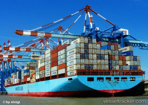
Vessel Sally Maersk IMO: 9120865, MMSI: 219324000 Container Ship
UTC, 43.48333, -157.38333, course: -1, speed: 17
UTC, 43.32464, -156.47206, course: 104, speed: 17.2
2026-03-24 23:38:28 UTC, 43.23436, -155.99586, course: 104, speed: 17.3
Live Vessel Sally Maersk Analytics (details, animations, etc.)
Live AIS position: UTC. 319 nm S of Krustetten), updated 2026-03-24 23:38:28 UTC.Find the position of the vessel Sally Maersk on the map. The latter are known coordinates and path.
marine traffic ship tracker show on live map
The current position of vessel Sally Maersk is 43.23436 lat / -155.99586 lng. Updated: 2026-03-24 23:38:28 UTCCurrently sailing under the flag of Denmark
Sally Maersk built in 1998 year
Deadweight:
110387 tDetails:
Last coordinates of the vessel:
UTC, 43.48333, -157.38333, course: -1, speed: 17UTC, 43.48333, -157.38333, course: -1, speed: 17
UTC, 43.32464, -156.47206, course: 104, speed: 17.2
2026-03-24 23:38:28 UTC, 43.23436, -155.99586, course: 104, speed: 17.3