 vesseltracker.com
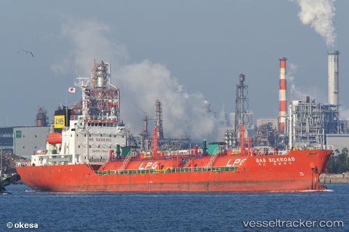
Vessel GAS KAHAYAN IMO: 9128881, MMSI: 525500863 LPG Tanker
UTC, -5.09018, 119.41827, course: 284, speed: 0
UTC, -5.09070, 119.41758, course: 9, speed: 0.1
2026-02-16 09:34:01 UTC, -5.09036, 119.41711, course: 33, speed: 0.1
Live AIS position:
UTC. Near Makassar),
updated 2026-02-16 09:34:01 UTC.
Find the position of the vessel GAS KAHAYAN on the map. The latter are known coordinates and path.
marine traffic ship tracker show on live map
The current position of vessel GAS KAHAYAN is -5.09036 lat / 119.41711 lng. Updated: 2026-02-16 09:34:01 UTCCurrently sailing under the flag of Indonesia
GAS KAHAYAN built in 1995 year
Deadweight:
3235 tDetails:
Last coordinates of the vessel:
UTC, -5.09054, 119.41786, course: 322, speed: 0.1UTC, -5.09018, 119.41827, course: 284, speed: 0
UTC, -5.09070, 119.41758, course: 9, speed: 0.1
2026-02-16 09:34:01 UTC, -5.09036, 119.41711, course: 33, speed: 0.1