 vesseltracker.com
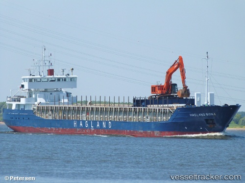
Vessel SNP WIND IMO: 9132038, MMSI: 314667000 General Cargo Ship
UTC, 53.47364, -3.36763, course: -1, speed: 0.1
UTC, 53.47331, -3.36761, course: 276, speed: 0.1
2026-02-27 06:23:15 UTC, 53.47333, -3.36667, course: -1, speed: 0
Live AIS position:
UTC. Near LIVERPOOL ANCH),
updated 2026-02-27 06:23:15 UTC.
Find the position of the vessel SNP WIND on the map. The latter are known coordinates and path.
marine traffic ship tracker show on live map
The current position of vessel SNP WIND is 53.47333 lat / -3.36667 lng. Updated: 2026-02-27 06:23:15 UTCCurrently sailing under the flag of Barbados
SNP WIND built in 1996 year
Deadweight:
3715 tDetails:
Last coordinates of the vessel:
UTC, 53.47333, -3.36667, course: -1, speed: 0UTC, 53.47364, -3.36763, course: -1, speed: 0.1
UTC, 53.47331, -3.36761, course: 276, speed: 0.1
2026-02-27 06:23:15 UTC, 53.47333, -3.36667, course: -1, speed: 0