 vesseltracker.com
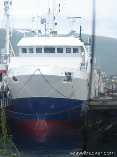
Vessel Viking Alliance IMO: 9137454, MMSI: 316014750 Fishing Vessel
UTC, 49.22578, -124.81420, course: 25, speed: 0
UTC, 49.22580, -124.81417, course: 25, speed: 0
2026-03-24 17:25:41 UTC, 49.22500, -124.81333, course: -1, speed: 0
Live Vessel Viking Alliance Analytics (details, animations, etc.)
Live AIS position: UTC. Near PORT ALBERNI), updated 2026-03-24 17:25:41 UTC.Find the position of the vessel Viking Alliance on the map. The latter are known coordinates and path.
marine traffic ship tracker show on live map
The current position of vessel Viking Alliance is 49.22500 lat / -124.81333 lng. Updated: 2026-03-24 17:25:41 UTCCurrently sailing under the flag of Canada
Viking Alliance built in 1996 year
Deadweight:
401 tDetails:
Last coordinates of the vessel:
UTC, 49.22500, -124.81333, course: -1, speed: 0UTC, 49.22578, -124.81420, course: 25, speed: 0
UTC, 49.22580, -124.81417, course: 25, speed: 0
2026-03-24 17:25:41 UTC, 49.22500, -124.81333, course: -1, speed: 0