 vesseltracker.com
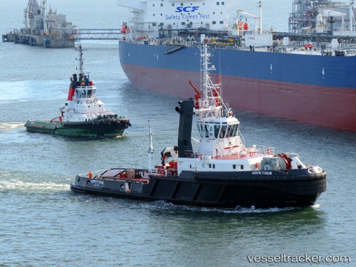
Vessel Hopetoun IMO: 9140865, MMSI: 232002720 Tug
UTC, 56.00102, -3.37412, course: 232, speed: 0.1
UTC, 56.00102, -3.37415, course: 234, speed: 0.4
2026-02-11 03:54:21 UTC, 56.00107, -3.37418, course: 243, speed: 0.1
Live AIS position:
UTC. Near SOUTH QUEENSFERRY),
updated 2026-02-11 03:54:21 UTC.
Find the position of the vessel Hopetoun on the map. The latter are known coordinates and path.
marine traffic ship tracker show on live map
The current position of vessel Hopetoun is 56.00107 lat / -3.37418 lng. Updated: 2026-02-11 03:54:21 UTCCurrently sailing under the flag of United Kingdom
Hopetoun built in 1997 year
Deadweight:
637 tDetails:
Last coordinates of the vessel:
UTC, 56.00144, -3.37392, course: 304, speed: 0.2UTC, 56.00102, -3.37412, course: 232, speed: 0.1
UTC, 56.00102, -3.37415, course: 234, speed: 0.4
2026-02-11 03:54:21 UTC, 56.00107, -3.37418, course: 243, speed: 0.1