 vesseltracker.com
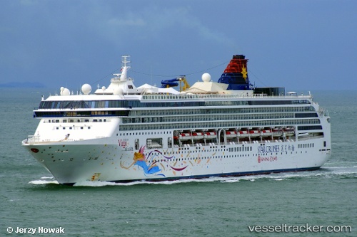
Vessel Explorer Dream IMO: 9141077, MMSI: 311000165 Cruise Ship
UTC, 24.48149, 123.91723, course: 306, speed: 13.8
UTC, 24.69767, 123.48380, course: 296, speed: 15.6
2026-03-24 17:29:25 UTC, 24.86833, 123.01833, course: -1, speed: 13
Live Vessel Explorer Dream Analytics (details, animations, etc.)
Live AIS position: UTC. 47 nm NW of Hatoma), updated 2026-03-24 17:29:25 UTC.Find the position of the vessel Explorer Dream on the map. The latter are known coordinates and path.
marine traffic ship tracker show on live map
The current position of vessel Explorer Dream is 24.86833 lat / 123.01833 lng. Updated: 2026-03-24 17:29:25 UTCCurrently sailing under the flag of Bahamas
Explorer Dream built in 1999 year
Deadweight:
8530 tDetails:
Last coordinates of the vessel:
UTC, 24.32869, 124.14080, course: -1, speed: 0UTC, 24.48149, 123.91723, course: 306, speed: 13.8
UTC, 24.69767, 123.48380, course: 296, speed: 15.6
2026-03-24 17:29:25 UTC, 24.86833, 123.01833, course: -1, speed: 13