 vesseltracker.com
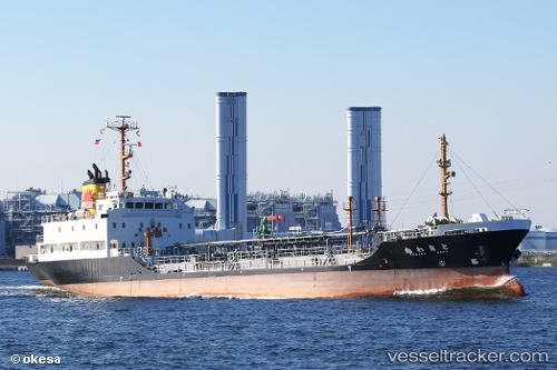
Vessel Tokiwamaru IMO: 9146857, MMSI: 431100272 Oil Products Tanker
UTC, 41.78390, 140.72513, course: 236, speed: 0
UTC, 41.78388, 140.72513, course: 236, speed: 0
2026-02-21 06:28:08 UTC, 41.78390, 140.72514, course: 236, speed: 0
Live AIS position:
UTC. Near Hakodate),
updated 2026-02-21 06:28:08 UTC.
Find the position of the vessel Tokiwamaru on the map. The latter are known coordinates and path.
marine traffic ship tracker show on live map
The current position of vessel Tokiwamaru is 41.78390 lat / 140.72514 lng. Updated: 2026-02-21 06:28:08 UTCCurrently sailing under the flag of Japan
Details:
Last coordinates of the vessel:
UTC, 41.78122, 140.68550, course: 187, speed: 0.1UTC, 41.78390, 140.72513, course: 236, speed: 0
UTC, 41.78388, 140.72513, course: 236, speed: 0
2026-02-21 06:28:08 UTC, 41.78390, 140.72514, course: 236, speed: 0