 vesseltracker.com
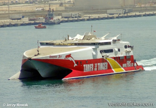
Vessel TARIFA JET IMO: 9150999, MMSI: 232059657 High speed craft
UTC, 50.00559, -1.31826, course: 213, speed: 22.9
UTC, 49.39597, -2.07169, course: 193, speed: 22.5
2026-03-24 19:30:11 UTC, 48.85879, -1.96367, course: 199, speed: 21.3
Live Vessel TARIFA JET Analytics (details, animations, etc.)
Live AIS position: UTC. Near Maitresse Island), updated 2026-03-24 19:30:11 UTC.Find the position of the vessel TARIFA JET on the map. The latter are known coordinates and path.
marine traffic ship tracker show on live map
The current position of vessel TARIFA JET is 48.85879 lat / -1.96367 lng. Updated: 2026-03-24 19:30:11 UTCCurrently sailing under the flag of United Kingdom
Details:
Last coordinates of the vessel:
UTC, 50.37770, -0.52498, course: 255, speed: 22.3UTC, 50.00559, -1.31826, course: 213, speed: 22.9
UTC, 49.39597, -2.07169, course: 193, speed: 22.5
2026-03-24 19:30:11 UTC, 48.85879, -1.96367, course: 199, speed: 21.3