 vesseltracker.com
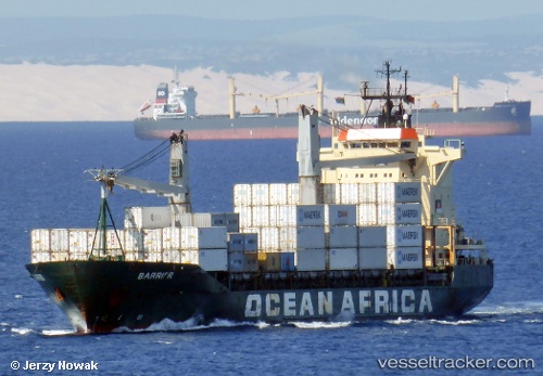
Vessel BARRIER IMO: 9151917, MMSI: 538090563 Container Ship
Live Vessel BARRIER Analytics (details, animations, etc.)
Live AIS position: UTC. Near PENGERANG), updated 2025-12-25 02:38:09 UTC.Find the position of the vessel BARRIER on the map. The latter are known coordinates and path.
marine traffic ship tracker show on live map
The current position of vessel BARRIER is 1.25140 lat / 104.15458 lng. Updated: 2025-12-25 02:38:09 UTCCurrently sailing under the flag of Marshall Islands
BARRIER built in 1998 year
Deadweight:
14357 tDetails:
Last coordinates of the vessel:
2025-12-25 02:38:09 UTC, 1.25140, 104.15458, course: 83, speed: 0