 vesseltracker.com
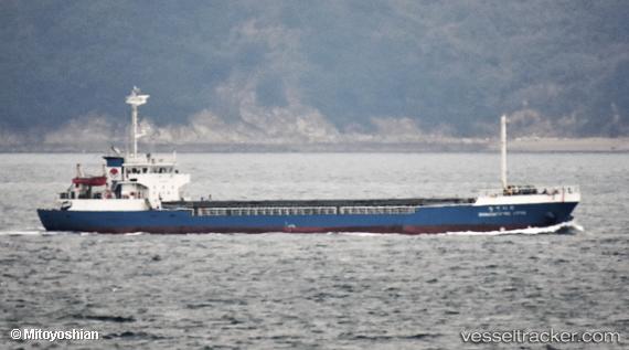
Vessel Baykal IMO: 9167617, MMSI: 667001819 General Cargo
UTC, 43.15167, 132.02167, course: -1, speed: 52
UTC, 43.16000, 132.01666, course: -1, speed: 17
2026-03-20 15:19:55 UTC, 42.72167, 131.85167, course: -1, speed: 17
Live Vessel Baykal Analytics (details, animations, etc.)
Live AIS position: UTC. 21 nm SE of Slavyanka ), updated 2026-03-20 15:19:55 UTC.Find the position of the vessel Baykal on the map. The latter are known coordinates and path.
marine traffic ship tracker show on live map
The current position of vessel Baykal is 42.72167 lat / 131.85167 lng. Updated: 2026-03-20 15:19:55 UTCCurrently sailing under the flag of Sierra Leone
Baykal built in 1997 year
Deadweight:
1600 tDetails:
Last coordinates of the vessel:
UTC, 43.05368, 131.92467, course: 121, speed: 6.9UTC, 43.15167, 132.02167, course: -1, speed: 52
UTC, 43.16000, 132.01666, course: -1, speed: 17
2026-03-20 15:19:55 UTC, 42.72167, 131.85167, course: -1, speed: 17