 vesseltracker.com
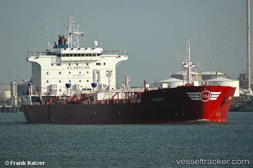
Vessel DIVINE POWER IMO: 9171357, MMSI: 306104000 Chemical/Oil Products Tanker
Live Vessel DIVINE POWER Analytics (details, animations, etc.)
Live AIS position: UTC. 290 nm E of Masirah), updated 2026-03-12 13:02:19 UTC.Find the position of the vessel DIVINE POWER on the map. The latter are known coordinates and path.
marine traffic ship tracker show on live map
The current position of vessel DIVINE POWER is 19.28472 lat / 63.83189 lng. Updated: 2026-03-12 13:02:19 UTCNearest reference points:
- 262 nm SE of SUR
- 231 nm SW of Keti Bandar
- 224 nm E of SUR
Currently sailing under the flag of Gabon
DIVINE POWER built in 2000 year
Deadweight:
44990 tDetails:
Last coordinates of the vessel:
2026-03-12 13:02:19 UTC, 19.28472, 63.83189, course: 270, speed: 1.2