 vesseltracker.com
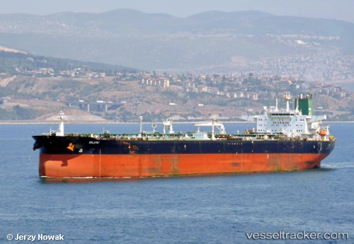
Vessel SILVIA I IMO: 9172052, MMSI: 422173000 Crude Oil Tanker
UTC, 1.93875, 104.62110, course: 30, speed: 5.1
UTC, 1.94732, 104.62733, course: -1, speed: 5.5
2026-03-21 09:33:03 UTC, 1.94732, 104.62733, course: -1, speed: 5.5
Live Vessel SILVIA I Analytics (details, animations, etc.)
Live AIS position: UTC. 47 nm NE of PENGERANG), updated 2026-03-21 09:33:03 UTC.Find the position of the vessel SILVIA I on the map. The latter are known coordinates and path.
marine traffic ship tracker show on live map
The current position of vessel SILVIA I is 1.94732 lat / 104.62733 lng. Updated: 2026-03-21 09:33:03 UTCCurrently sailing under the flag of Iran
SILVIA I built in 2000 year
Deadweight:
159711 tDetails:
Last coordinates of the vessel:
UTC, 1.67097, 104.58291, course: 359, speed: 10.2UTC, 1.93875, 104.62110, course: 30, speed: 5.1
UTC, 1.94732, 104.62733, course: -1, speed: 5.5
2026-03-21 09:33:03 UTC, 1.94732, 104.62733, course: -1, speed: 5.5