 vesseltracker.com
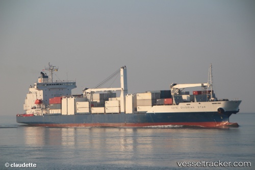
Vessel Cote D Ivoirian Star IMO: 9172478, MMSI: 636014241 Refrigerated Cargo Ship
UTC, 49.93033, -2.44513, course: 75, speed: 12.8
UTC, 50.04292, -2.17425, course: 56, speed: 11.5
2026-02-23 17:30:57 UTC, 50.24798, -1.78027, course: 62, speed: 4.3
Live AIS position:
UTC. 22 nm SE of Worth Matravers),
updated 2026-02-23 17:30:57 UTC.
Find the position of the vessel Cote D Ivoirian Star on the map. The latter are known coordinates and path.
marine traffic ship tracker show on live map
The current position of vessel Cote D Ivoirian Star is 50.24798 lat / -1.78027 lng. Updated: 2026-02-23 17:30:57 UTCCurrently sailing under the flag of Liberia
Cote D Ivoirian Star built in 1998 year
Deadweight:
10350 tDetails:
Last coordinates of the vessel:
UTC, 49.76631, -3.12266, course: 61, speed: 15.4UTC, 49.93033, -2.44513, course: 75, speed: 12.8
UTC, 50.04292, -2.17425, course: 56, speed: 11.5
2026-02-23 17:30:57 UTC, 50.24798, -1.78027, course: 62, speed: 4.3