 vesseltracker.com
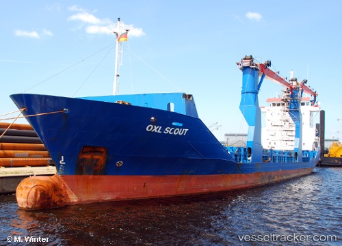
Vessel Scout IMO: 9184706, MMSI: 304664000 Multi Purpose Carrier
UTC, 12.16602, -84.22980, course: 303, speed: 0.1
UTC, 12.16602, -84.22980, course: 303, speed: 0.1
2026-03-22 14:42:36 UTC, 12.16602, -84.22980, course: 303, speed: 0.1
Live Vessel Scout Analytics (details, animations, etc.)
Live AIS position: UTC. Near Rama), updated 2026-03-22 14:42:36 UTC.Find the position of the vessel Scout on the map. The latter are known coordinates and path.
marine traffic ship tracker show on live map
The current position of vessel Scout is 12.16602 lat / -84.22980 lng. Updated: 2026-03-22 14:42:36 UTCCurrently sailing under the flag of Antigua Barbuda
Scout built in 1999 year
Deadweight:
3479 tDetails:
Last coordinates of the vessel:
UTC, 12.16602, -84.22979, course: 303, speed: 0UTC, 12.16602, -84.22980, course: 303, speed: 0.1
UTC, 12.16602, -84.22980, course: 303, speed: 0.1
2026-03-22 14:42:36 UTC, 12.16602, -84.22980, course: 303, speed: 0.1