 vesseltracker.com
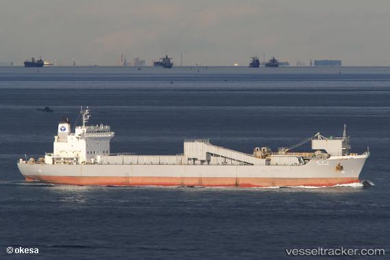
Vessel Taisetsu Maru IMO: 9185803, MMSI: 431100522 Limestone Carrier
UTC, 35.93646, 141.03235, course: 7, speed: 14.2
UTC, 36.14921, 141.08919, course: 14, speed: 13.6
2026-02-14 21:58:06 UTC, 36.68564, 141.18355, course: 5, speed: 13.6
Live AIS position:
UTC. 20 nm SE of ONAHAMA),
updated 2026-02-14 21:58:06 UTC.
Find the position of the vessel Taisetsu Maru on the map. The latter are known coordinates and path.
marine traffic ship tracker show on live map
The current position of vessel Taisetsu Maru is 36.68564 lat / 141.18355 lng. Updated: 2026-02-14 21:58:06 UTCCurrently sailing under the flag of Japan
Details:
Last coordinates of the vessel:
UTC, 35.39500, 140.74167, course: -1, speed: 14UTC, 35.93646, 141.03235, course: 7, speed: 14.2
UTC, 36.14921, 141.08919, course: 14, speed: 13.6
2026-02-14 21:58:06 UTC, 36.68564, 141.18355, course: 5, speed: 13.6