 vesseltracker.com
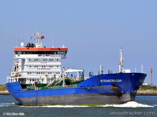
Vessel STENSTRAUM IMO: 9187394, MMSI: 636024183 Oil/Chemical Tanker
UTC, 22.00240, 115.39804, course: 79, speed: 12.5
UTC, 22.14333, 115.77167, course: -1, speed: 13
2026-03-24 18:06:22 UTC, 22.30737, 116.23941, course: 75, speed: 12.5
Live Vessel STENSTRAUM Analytics (details, animations, etc.)
Live AIS position: UTC. 35 nm S of Jiazi), updated 2026-03-24 18:06:22 UTC.Find the position of the vessel STENSTRAUM on the map. The latter are known coordinates and path.
marine traffic ship tracker show on live map
The current position of vessel STENSTRAUM is 22.30737 lat / 116.23941 lng. Updated: 2026-03-24 18:06:22 UTCCurrently sailing under the flag of Liberia
Details:
Last coordinates of the vessel:
UTC, 21.88167, 114.98500, course: -1, speed: 12UTC, 22.00240, 115.39804, course: 79, speed: 12.5
UTC, 22.14333, 115.77167, course: -1, speed: 13
2026-03-24 18:06:22 UTC, 22.30737, 116.23941, course: 75, speed: 12.5