 vesseltracker.com
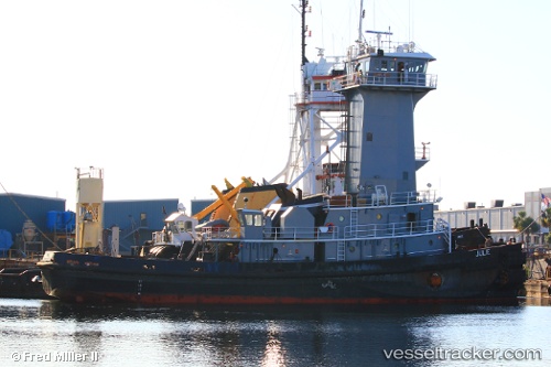
Vessel PORTO IMO: 9187552, MMSI: 760003650 Pusher Tug
UTC, 8.77869, -79.58777, course: 313, speed: 4
UTC, 8.81289, -79.60981, course: 135, speed: 0.1
2026-02-25 11:47:48 UTC, 8.81225, -79.60941, course: 135, speed: 0
Live AIS position:
UTC. Near Melones),
updated 2026-02-25 11:47:48 UTC.
Find the position of the vessel PORTO on the map. The latter are known coordinates and path.
marine traffic ship tracker show on live map
The current position of vessel PORTO is 8.81225 lat / -79.60941 lng. Updated: 2026-02-25 11:47:48 UTCCurrently sailing under the flag of Peru
PORTO built in 1998 year
Deadweight:
0 tDetails:
Last coordinates of the vessel:
UTC, 8.60280, -79.38236, course: 358, speed: 10.6UTC, 8.77869, -79.58777, course: 313, speed: 4
UTC, 8.81289, -79.60981, course: 135, speed: 0.1
2026-02-25 11:47:48 UTC, 8.81225, -79.60941, course: 135, speed: 0