 vesseltracker.com
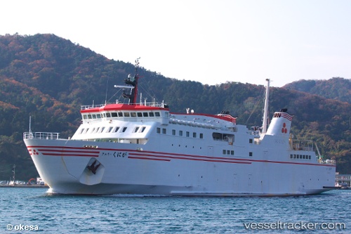
Vessel Ferry Kuniga IMO: 9189196, MMSI: 431401646 Passenger Ro Ro Cargo Ship
UTC, 36.20070, 133.33704, course: 347, speed: 9.6
UTC, 36.13159, 133.34288, course: 188, speed: 18.1
2026-03-24 07:25:44 UTC, 35.57391, 133.23119, course: 232, speed: 9.6
Live Vessel Ferry Kuniga Analytics (details, animations, etc.)
Live AIS position: UTC. Near SHICHIRUI), updated 2026-03-24 07:25:44 UTC.Find the position of the vessel Ferry Kuniga on the map. The latter are known coordinates and path.
marine traffic ship tracker show on live map
The current position of vessel Ferry Kuniga is 35.57391 lat / 133.23119 lng. Updated: 2026-03-24 07:25:44 UTCDetails:
Last coordinates of the vessel:
UTC, 36.10918, 133.05894, course: 82, speed: 13UTC, 36.20070, 133.33704, course: 347, speed: 9.6
UTC, 36.13159, 133.34288, course: 188, speed: 18.1
2026-03-24 07:25:44 UTC, 35.57391, 133.23119, course: 232, speed: 9.6