.
vessel De Hong IMO: 9191981, Offshore Tug Supply Ship
vesseltracker.com
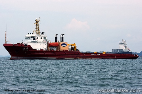
Vessel De Hong IMO: 9191981, MMSI: 412681000 Offshore Tug Supply Ship

callsign: BSCE
size: 96x96

Live AIS position: UTC. Near Gonglu), updated 2023-01-10 01:25:49 UTC.

Find the position of the vessel De Hong on the map. The latter are known coordinates and path.

marine traffic ship tracker show on live map

The current position of vessel De Hong is 31.36183 lat / 121.79693 lng. Updated: 2023-01-10 01:25:49 UTC

Currently sailing under the flag of China

De Hong built in 2000 year

Deadweight:
2453 t

Details:


Last coordinates of the vessel:
2023-01-10 01:25:49 UTC, 31.36183, 121.79693, course: 170, speed: 0

Track of the vessel in the last 28 days


Most frequent ports a vessels calls at De Hong (412681000):

Sambu, traffic: 3
Xiamen, traffic: 2
Wusong, traffic: 1
Yeosu, traffic: 1
Yosu, traffic: 1
Basuo Gang, traffic: 1
Hsia-Men, traffic: 1
Singapore, traffic: 1
Vancouver, traffic: 1
Victoria, traffic: 1
Wu-Sung, traffic: 1

Link to the map:


Find another ship

De_Hong (412681000) last ports (portcalls and passsages)

Wusong | 2022-12-08 11:57:58
Yosu | 2022-10-05 04:59:43
Victoria | 2022-08-22 13:16:51
Vancouver | 2022-08-21 23:09:20
Basuo Gang | 2022-07-01 22:28:34
Singapore | 2022-04-20 22:00:50
Sambu | 2022-03-20 09:50:20
Xiamen | 2022-02-07 04:08:50